Underwater robotics · Archaeological mapping

DEEP-UNDER ROV

Development of Experimental and Exploratory Photogrammetry for Supporting Underwater Archaeological Studies using Remotely Operated Vehicle

Development of a low-cost ROV and multi-modal mapping framework for underwater archaeological documentation in Indonesia.

The DEEP-UNDER ROV team preparing the underwater vehicle
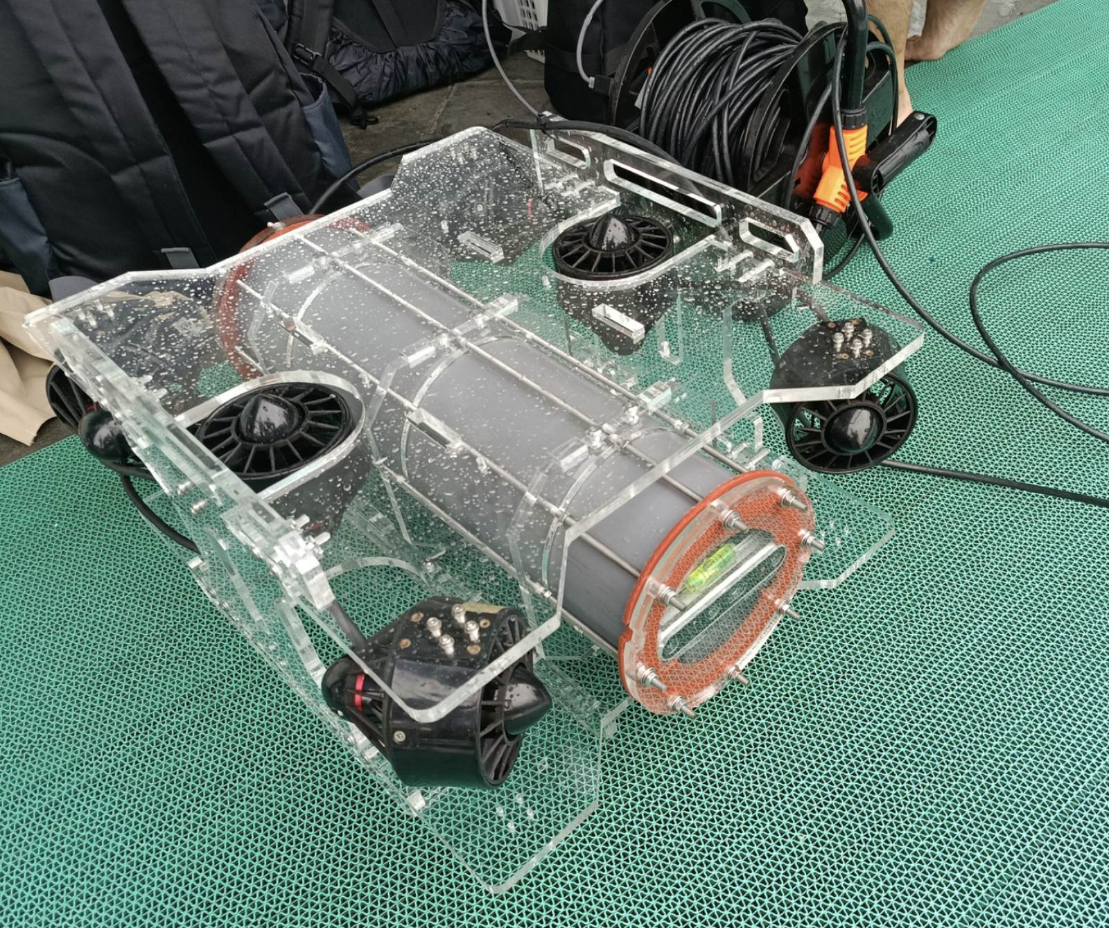
SUPRI-ROV v3.0 Current six-degree-of-freedom research platform
Status Ongoing
Active period2025–2026
Lead institutionInstitut Teknologi Bandung
Field focusIndonesia's shallow tropical waters

01 · Overview

Project Overview

DEEP-UNDER ROV develops a low-cost remotely operated vehicle and multi-modal mapping methods for underwater archaeological documentation in shallow tropical waters.

The research covers mechanical and electrical design, vehicle control, state estimation, underwater imaging, visual-inertial SLAM, photogrammetry, acoustic sensing, and 3D reconstruction.

Long-term direction

The long-term objective is a multi-modal survey platform for digital-twin generation, autonomous data acquisition, and coordinated multi-vehicle mapping.

Upcoming field experiment

Pramuka Island
21–26 October 2026

The current platform will be used for field testing, underwater data collection, positioning, and mapping experiments.

02 · Research focus

Annual Research Focus

2025

Platform feasibility

The 2025 work evaluated a low-cost ROV assembled from components available through the domestic supply chain. Underwater cameras and pressure sensing were integrated with the mechanical and electrical systems. The platform and an initial visual-SLAM pipeline were tested in controlled and coastal environments.

The tests evaluated the effects of illumination, turbidity, vehicle motion, viewing geometry, and sensor integration.
2026

Mapping quality and robustness

The 2026 work focuses on data-acquisition reliability and geometrically consistent reconstruction.

01

Hardware Mechanical design, waterproofing, power, leak detection, and six-degree-of-freedom actuation

02

Control Modelling, simulation, visual servoing, trajectory tracking, and active perception

03

Estimation & SLAM Stereo vision, inertial sensing, depth, acoustics, Kalman estimation, and underwater camera modelling

04

3D reconstruction Photogrammetry, point clouds, Gaussian splatting, acoustic constraints, and quality assessment

03 · Progress

Project Milestones

September 2025

01

SUPRI-ROV v1.0 and feasibility testing

The first four-degree-of-freedom prototype established the mechanical frame, propulsion arrangement, onboard electronics, cameras, pressure sensing, and tethered operator workflow. Laboratory and pool tests confirmed that the platform could support underwater inspection and visual-mapping research.

SUPRI-ROV version 1 prototype on a workbench
SUPRI-ROV v1.0
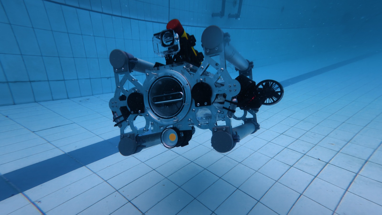
DEEP-UNDER ROV undergoing a pool test
Controlled pool testing
Late 2025

02

Coastal validation and initial visual SLAM

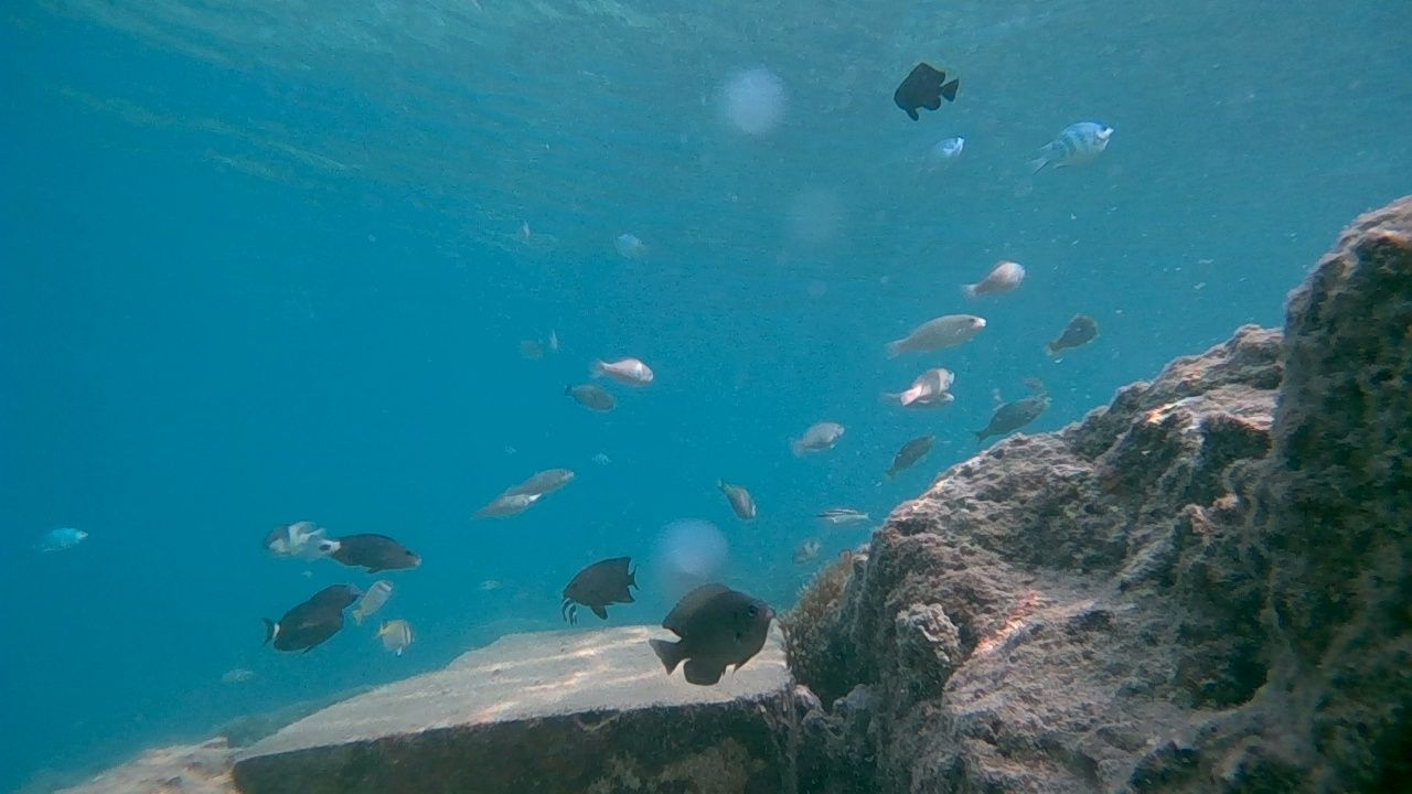
Field tests at Pramuka Island evaluated underwater operation at depths of up to 12 metres. The recorded imagery was used for camera-trajectory estimation and sparse 3D reconstruction.

Underwater coastal image
Coastal imagery
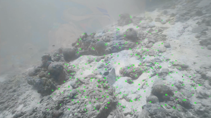
Extracted underwater visual features
Feature extraction
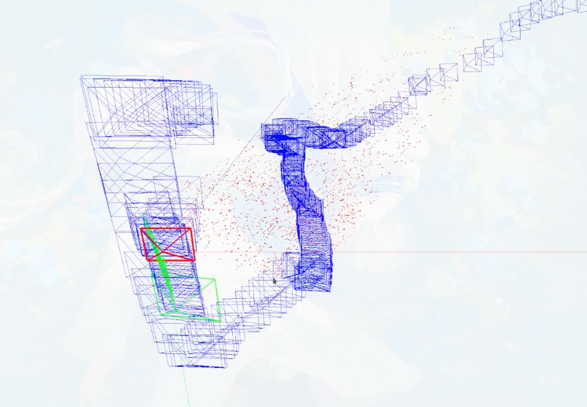
Estimated camera trajectory and sparse point cloud
Initial visual SLAM
January 2026

03

SUPRI-ROV v2.0 hardware refinement

The second four-degree-of-freedom iteration refined the enclosure, sealing, component layout, and electrical integration, moving the project from an initial feasibility platform toward a system designed for repeated experiments.

SUPRI-ROV version 2 on a testing bench
System integration, January 2026
May 2026

04

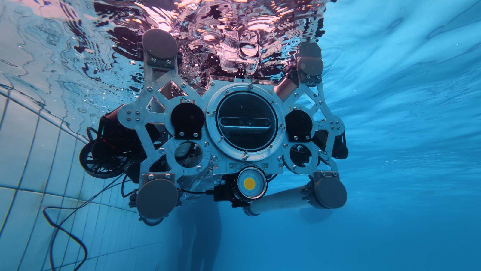
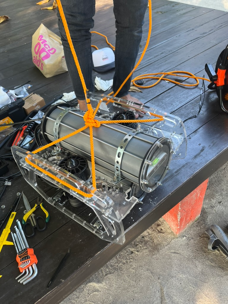
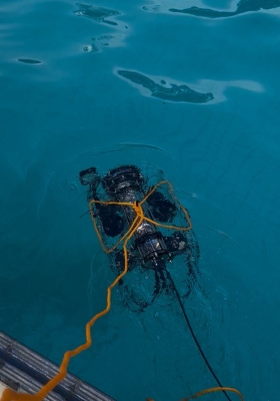
SUPRI-ROV v3.0 and six-degree-of-freedom operation

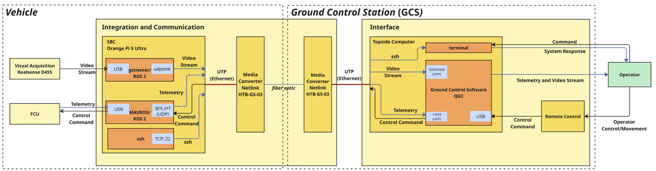
The current platform expands motion capability to six degrees of freedom and improves sealing, cable management, power switching, leak detection, fibre-optic communication, and ground-control integration.

Team preparing the ROV for field operation
Field preparation
SUPRI-ROV version 3 underwater
SUPRI-ROV v3.0
June–August 2026

05

Control, estimation, SLAM, and reconstruction

This stage covers a Gazebo and ROS 2 simulator, stereo-enhanced image-based visual servoing, and visual-inertial Kalman estimation. A PINAX underwater camera model was integrated into a stereo visual-inertial SLAM pipeline and evaluated through pool tests at Saraga.

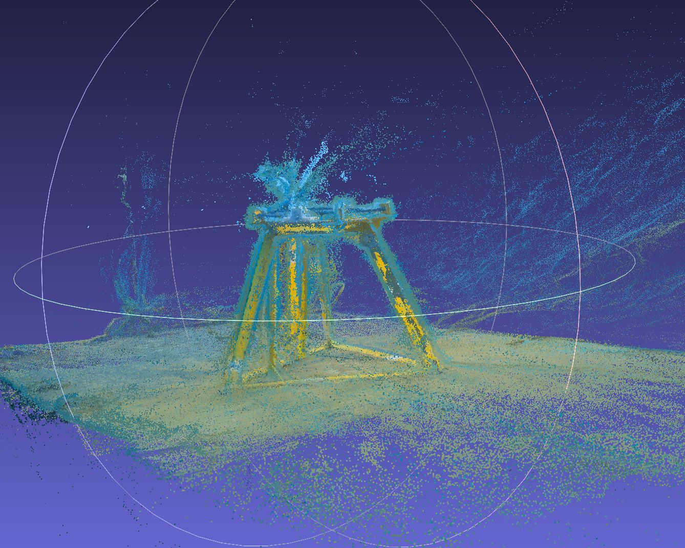
Visual-SLAM and Gaussian-splatting experiments use data from Saraga Pool and Pramuka Island, including data acquired around an ADCP support frame.

ROV and ground-control system architecture
System architecture
3D point-cloud reconstruction of an underwater structure
3D point-cloud reconstruction
October–November 2026

06

Pramuka Island mission and project completion

The 21–26 October field experiment will test the platform and mapping workflow at Pramuka Island. The programme includes underwater data collection, positioning and reconstruction experiments, and preparation of the final 2026 research outputs.

04 · People and partners

Research Team

Researchers

Students

Current

  • Wafi Abiyyu YasinSTEI ITB
  • Ibrahim Hanif MulyanaSTEI ITB
  • Yayat NurhidayatSTEI ITB
  • Muhammad Aqeel GhaniSTEI ITB
  • Rusydi Noor AbdurrahmanSTEI ITB
  • Adli SyauqiSTEI ITB
  • Anggraini Rizkita PujiFITB ITB

Graduated

  • Matthew Troy PutraSTEI ITB
  • Dwi Hadi NugrahaFITB ITB
  • Riswandha MashuriSTEI ITB

Source of funds

Institut Teknologi Bandung internal research funding

Riset ITB 2025 and Riset Dosen Muda ITB 2026

Institut Teknologi Bandung INSA Strasbourg Badan Riset dan Inovasi Nasional HafenCity University Hamburg

05 · Documentation

Documentations of the development

Simulation and progress

SUPRI-ROV simulationGazebo and ROS 2
Visual-SLAM reconstructionTrajectory and scene structure
Gaussian splattingDense scene reconstruction

Field, SLAM, and reconstruction

ROV visual SLAMFeatures, trajectory, and sparse map
Stereo visual SLAMRectified views and vehicle trajectory
Underwater Gaussian splattingReconstructed scene rendering

06 · Publications

Publications

Conference paper · IEEE ASCC 2026

Stereo-Enhanced Image-Based Visual Servoing for Low-Cost Underwater Remotely Operated Vehicle

Read on IEEE Xplore ↗